

TRAIL ETIQUETTE
As an organization dedicated to sustainable mountain biking, we are committed to following IMBA’s “Rules of the Trail.” Your actions have critical impacts on the landscape, the trails, the animals, and other trail users. Pledge to ride friendly, ride prepared, ride responsibly, ride lightly.
Featured Trails
-

Rainbow Trail
This is a mixed singletrack and doubletrack (mostly singletrack) trail that runs from Silverton up to the bottom of Ophir pass. This trail is great as an out-and-back, with a fun descent back into Silverton or as a link to Ophir Pass.
Varied conditions exist here quite often as there are a few scree fields to navigate, early spring run off can create creek crossings, and snow patches exist until late spring. Trail conditions have been improving in recent years due to local trail work days. The descent from Ophir Pass is almost entirely downhill.
-
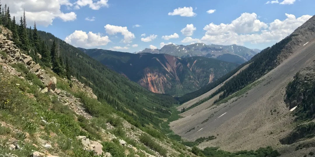
Bear Creek
Old pack trail that is used by bikers and Hardrock Hundred racers occasionally. Highly recommended to start from the Colorado Trail and go down. Top part is pretty overgrown with alpine willow. A bit of traversing and climbing takes you to a hunting camp in the beautiful Putnam Basin. Awesome riding above treeline to your west. Past the camp is probably to best section of downhill into the woods. Then its a lot of scree traversing thru seemingly endless rock gardens. Some old mining roads mark the end as you drop into Mineral Creek. Water level could be too high in early summer or after rains. Rumor has it the trail will be officially maintained and rerouted to finish at a bridge. Support the Silverton Singletrack Society and make it happen.
-

Boulder Gulch
This is a hardcore alpine adventure ride. Not to be taken lightly because of the remoteness, elevation, and exposure to lightning. Usually done as shuttle from Velocity Basin.
Its a little tricky find the best route up out of Velocity but after leaving the basin it gets better. A steep hike-a-bike is the name off the game to gain the ridge and get to the trail. If it looks like dark clouds are moving in, get the hell down, lightning strikes are very common up here.
Once you reach the trail on the ridgeline the real fun begins. The top part of the descent is mainly natural wildflower meadows with the occasional rock cairn to look out for. About 1/3 down, the trail is more defined. The last 1/3 of the trail is well established, fast, and flowy. Makes for a long/ steep out and back from the Animas River side.
Don’t trespass down into the mine property below the bottom creek crossing. Stay high and follow the road back to the edge of Silverton.